Designing a Green, Transit-Oriented Beltline Corridor
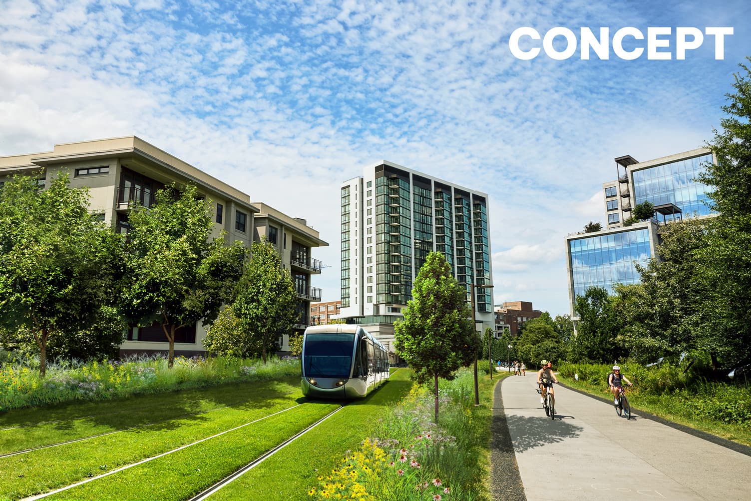
Bordeaux. Nice. Strasbourg. All three of these French cities are well-known in the transit community for having safe, green, light rail that marries seamlessly into the scenic environment around it. ...
![]()
At the Atlanta Beltline, we’re on a mission to do the same with the transit system that will run along our 22-mile corridor.
Like our French counterparts, we’ve always had a vision of transit that marries seamlessly with our multi-use path and the lush environment we’ve worked with Trees Atlanta for so many years to build.
We’re proud of the arboretum on the Beltline. It’s something our team members and partners have worked passionately to create and preserve. And something that won’t be eliminated when we introduce transit.
Just ask Megan Injaychock, one of the Beltline’s senior project managers who is especially passionate about the corridor’s landscaping and greenery. We recently sat down with Meghan to talk about her passion for design, how it has shaped the current trail, and how she (and the rest of the Beltline team) has planned for future transit.
What’s your current role with the Beltline, and how long have you been with the team?
M: I joined the team as an Atlanta Beltline, Inc. Fellow in 2012 before transitioning to full-time in 2013. I currently serve as a senior project manager; I’m also a trained landscape architect and urban planner.
What drew you to a degree in landscape architecture?
M: My mother was an interior designer, and my grandfather was in construction, so I’ve been around design since I was young.

When it came time to apply for college, my mother encouraged me to try something new outside of interior design. I also wanted to give myself a way to stand out. So, I looked up the major with the least female students. At the time it was landscape architecture. I put it on my application, got in, and started major-related classes the first semester. I ended up really loving it! The college was very small, so you were close to your classmates and knew the professors. I also wanted to contribute something concrete (not a trail pun) to the world and this allowed me to do that.
I never found out if it helped me get into college, but I don’t regret how I found out about the profession.
How do you incorporate different landscape architecture principles into the projects you oversee for the Beltline?
M: When I started as an intern, we were designing and building the Eastside Trail from Irwin Street to Monroe Drive. We worked with our design team to come up with how to break down the 22-mile loop into more bite-sized pieces.
They came up with the concept of “rooms” that have the same hardscapes (trail, handrails, lighting, etc.) but tell different stories with the trees. The concept has varied over the years, but we have several collections, like the Magnolias at Greenwood Avenue, which are inspired by the original room plans.
Another principle I’ve incorporated is the idea that you’re only as good as your maintenance plan. In school you aren’t taught to think of how your designs will be maintained. When designing trails and parks, we work closely with Trees Atlanta and the Department of Parks and Recreation to find the best way to make sure these projects can last and grow.
What’s something people might not know about when it comes to the design of the Beltline?
M: Because we see thousands of users a day, all our materials must be built to withstand that.
We have a palate of tough, tested materials that are standard throughout the corridor. We chose stainless steel handrails because they survive the most use without much maintenance. We use locally sourced granite for the walls and features because it’s tough, lasts, and is easily pressure washed. The same goes for our trail signs. Before deciding on a material, we spent months testing out different options. We literally used hammers and spray paint on each prototype to see how they would hold up so we could pick the best option.
Another thing most people might not know is that most of what we construct is never really seen by the public: the fiber duct bank that runs under the trails, the stormwater infrastructure, and the reinforcement in the trail itself.
Finally, most people likely don’t know what happens with our plantings. My favorite days are when Trees Atlanta stake out where the trees will be planted. We get to move stakes around from where the plans have them based on what we see in the field.
Do you have a segment or piece of the trail that’s your favorite aesthetically?
M: I have a few!
The corridor between Wylie Street and Memorial Drive was one of my first projects. The Cana Lilies there that everyone loves were a complete accident. The contractor couldn’t find the grass we specified, so they just ordered red Canas. We were about to open the trail, so we just went with it. Now they’re a seasonal favorite.
The entrance to Memorial Drive was my favorite planting palate. It features Prickly Pear, Fig, Mint, Yucca, and Rosemary. We had never used any of these plants on the trail, but they’re tough and were inspired by plants already on an adjacent property.
Another piece I’m proud of is the planting from Ansley Mall to Buford Highway. Just days before our trees were set to arrive, we learned we needed 2-3 more feet of corridor to fit future transit. Trees Atlanta and I went out to move hundreds of tree stakes to fit within this new smaller profile. The result is different than any planting we’ve ever done.
Thinking about transit, how was the Beltline designed to incorporate future transit?
M: As I alluded to, we’ve always thought about transit when designing the trail. Wherever possible we’ve tried to avoid planting or putting trail within a 35’ (minimum) area reserved for transit.
I’m currently managing the construction of the Northeast Trail from Monroe Drive to Westminster Drive. We got permission from the Atlanta Parks Department to put the trail in Piedmont Park to reserve the transit corridor (which is too narrow for both trail and transit).
Is it true that transit means getting rid of all the trees and greenery along the trail?
M: No! All the greenery in terms of shrubs, grasses, and trees will still be a part of the trail after the Streetcar East Extension (and the rest of the transit network) has been built. While some of the existing trees and landscaping will change, replantings are planned to restore any of the arboretum removed. We’re planning a nearly 1 to 1 replacement (as per the City of Atlanta’s tree ordinance and our core value) and are working with MARTA to save as many of the existing trees as possible.
What excites you the most about the future of the Beltline?
M: Aside from dreaming about maintenance? I am excited to see how what we have worked so hard on changes the way people move through our city! Each segment is different, and the more we build it out, the more people will be able to experience the city outside their car.
When we first opened the trail, we had to rush order trash cans because people thought we wouldn’t need more than two. We knew this would be a successful project, but we never thought it would reach the level it has.
To learn more about our vision for safe, green, innovative transit along the corridor, click here.
Subscribe to In The Loop, our monthly newsletter, for Beltline news, events, announcements and more.