Atlanta Beltline, Inc. and PATH Foundation to Collaborate on Northwest Trail
Collaboration will expedite delivery of planning, design, and construction The Atlanta Beltline, Inc. (ABI) and the PATH Foundation teams will work ...
- Parks & Trails
Collaboration will expedite delivery of planning, design, and construction

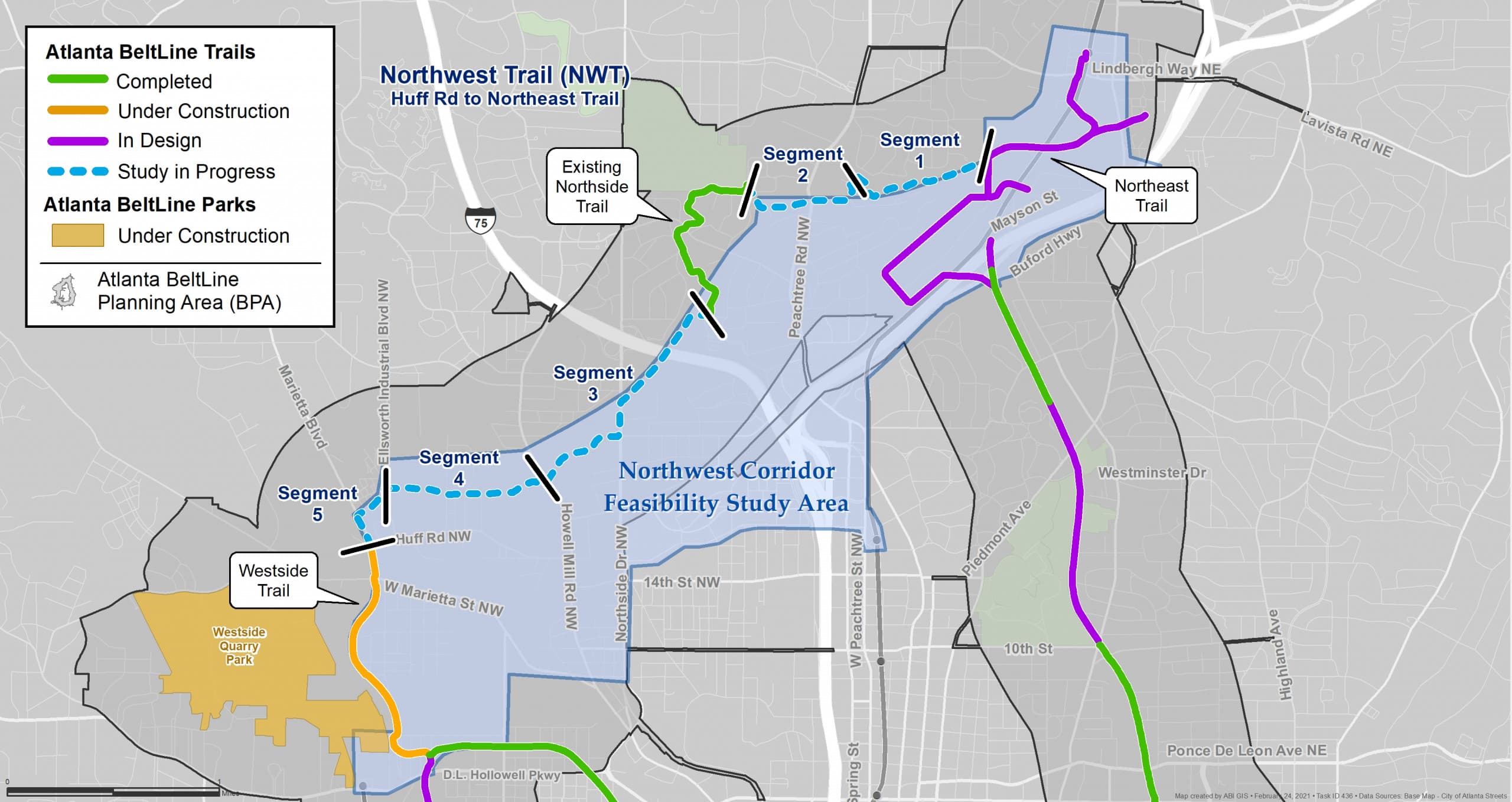
Atlanta Beltline Northwest Trail and corridor feasibility study area map
The Atlanta Beltline, Inc. (ABI) and the PATH Foundation teams will work together to deliver the Northwest Trail on an expedited schedule. As a result, ABI has cancelled the Request for Statements of Qualifications for the Northwest Trail Feasibility Study and PATH will manage the procurement for this study. PATH will fund the planning study utilizing their budget, which preserves ABI’s study budget for use on design or construction in this segment as part of the $350 million Special Service District (SSD) funding.
The 4.4-mile Northwest Trail will run from Huff Road on the westside to the Northeast Trail at Peachtree Creek in southern Buckhead. The development of the northwest corridor is critical to ABI’s goal of closing the 22-mile loop and building on Atlanta’s regional trail network. PATH’s ability to quickly start the planning study is expected to significantly shorten the schedule for this phase of work.
ABI and PATH have a long history of successfully collaborating on Atlanta Beltline Trails. In 2008 and 2010, PATH Foundation built the West End Trail; in 2012, PATH built the Northside Trail through Tanyard Creek Park and partially funded and managed the construction of the Eastside Trail; and in 2013, opened the Southwest Beltline Connector Trail. Following the recent success in delivering PATH’s Beltline Westside Connector Trail and embarking on construction of ABI’s Westside Trail Segment 3 (along Marietta Boulevard to Huff Road), the two organizations have developed a model that leverages the different strengths of both companies. The northwest corridor will connect current and future trails built by both organizations: the Atlanta Beltline’s Northside Trail, Northeast Trail, and Westside Trail and PATH Foundation’s Silver Comet Trail, PATH 400, Northwest Beltline Connector, and Westside Beltline Connector.
ABI will continue to lead all community engagement activities, alongside PATH. PATH is committed to ABI’s goals to hire Disadvantaged Business Enterprises (DBEs). PATH will maintain established Beltline design standards and will continue to work closely with ABI’s in-house engineering, landscape architecture, and real estate teams.
ABI anticipates releasing a separate Request for Qualifications this spring to commission a feasibility study for transit, to be funded by a federal grant. The selected consultants will work together seamlessly to define both trail and transit alignments.
ABI will post additional information about the northwest corridor as it becomes available and all public meetings on the topic will be posted on www.beltline.org/meetings.
Subscribe to In The Loop, our monthly newsletter, for Beltline news, events, announcements and more.